Two Exciting New Products! Lots of US History Help!

I’ve been slaving away behind the scenes to finish something I’ve been working on for a while! The first is a massive list of US History Assignments. I ended up with over 211 assignments and 15 printable templates! I’m breaking them up into 2 separate products based on time period. The first is 101 Assignments for Colonies to Civil War. I’m still putting the finishing touches on the second part, 110 Assignments for Reconstruction to 9/11. I hope to have that one available within the month!

I also have a set of 180 discussion starters and bell ringers I’ve been working on. You can find that here which also includes a link to a free sample download.

Use the code BLOG20 to get 20% off of your purchase!


US Expansion Map and Quick Manifest Destiny Assignment

When covering the idea of manifest destiny and how it contributed to the Mexican-American War, a map is always helpful. Maps like the one linked below summarize lots of historical information in a friendly, visual format that makes it far easier for students to understand and remember. Use the blank expansion map found here (page 3) to help your students understand the idea of manifest destiny and its effect on expansion.

How?

After discussing manifest destiny, give your students a blank copy of the expansion map. Have them label the official United States up to 1844 (before Texas was added). Tell them to illustrate what manifest destiny would look like on that map. Tell them they need to include arrows to show which way the US is expanding and to add any other words, pictures, or symbols needed to accurately convey the concept. (My students drew things like wagons trains, telegraph lines, steam trains, and stick people heading west.) Be sure to have them write the term manifest destiny at the top.

Then have students label the territory owned by Mexico before the Mexican-American War (it’s labeled as the Mexican cession on page 2) and that of Texas.

After the students have labeled their maps, ask the following questions: What country or territories are in the way of the US fulfilling its manifest destiny at this time in history? What could the US do to gain these territories?

This discussion should help students understand why President Polk felt it was necessary to provoke a war with Mexico in order to gain territory.

You can also use this document to

  • Teach students about each of the major US territorial gains and how we acquired them
  • Review US territorial gains before an end of course test
Image: Creative Commons Attribution-Share Alike 3.0 Unported

Gold Rush Primary Source and Meme

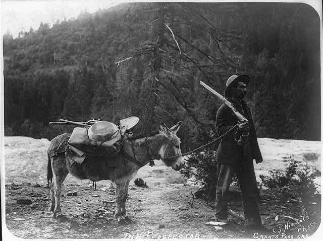
Once again, history references show up in popular culture.  Put the picture to the right on your board at the start of class the day after you talk about the 1849 Gold Rush, and see if you can get a laugh out of your students.  (It’s also a reference to the Kanye West song Gold Digger.  Don’t ask me how I know that…I’m not even sure myself.)

While we are on the topic of the Gold Rush, I thought I’d mention this.  This letter is an interesting primary source about the California Gold Rush written by a gold miner in 1850.

You could:

  • Read it and highlight portions to read aloud to your students (make them do Window Notes to encourage active listening).
  • Copy and paste the best portions for your students to read.  Have students write a reflection about whether they would have enjoyed participating in the Gold Rush based on what they read in the letter.

If you don’t have time to read the whole thing, read a summary of the best parts of the letter here.  (Scroll down to “Getting the Gold” for most relevant material.)

Maps…They’re Not Just For Geography

Did you know that I could once name and locate all of the countries in Africa?  How many people can say that?  (Well, you might be able to if you teach Geography, but even most social studies teachers don’t know them unless they end up teaching a geography class.)  How did I do that?  It was quite simple.  I had a really good college professor that loved geography and made African geography interesting.  One of the most helpful and yet simple activities we did in class was to color and label a map of Africa.  Yes, we colored…in college…and it worked.  I know that adult coloring is all the rage right now, but when I was in college most people would have looked down on a professor that resorted to coloring to teach a college class.  I have a very distinct memory of myself sitting in class at Clemson University coloring maps and LOVING it!  It seemed simple, but coloring maps appealed to various learning styles of the students in the classroom and enforced the content multiple ways.

So, what does that have to do with US History?  Oftentimes, we talk about land acquisitions without ever showing students a map of the result of said acquisition.  Yes, the Louisiana Purchase made a HUGE impact on the size and natural resources of the US; but you don’t really get an idea of just how huge it was until you show it on a map.  Did you remember the size of the Louisiana Purchase from your high school classes?  Probably not.  But how many maps were you shown?  How many did you color and label?  Probably none.

You get my point.  Give your students blank maps and have them color and label important historical events, acquisitions, or information.  Don’t think you have time?  Some maps will only take 5 minutes to complete.  You can always set a time limit and whatever the students don’t finish in class must be completed for homework.  Some maps, such as a map showing land acquisitions of the US, would serve as excellent end of course review material!  See some examples of assignments below:

American Colonies Map – Use the map found here.  (No longer available.) Have students create a map of the 13 colonies.  Students must label each colony and color the three main colony divisions:   northern, southern, and middle colonies (or mid-Atlantic).  Students must also insert symbols for economic activities and religious groups.  Students must create a legend to go with their map.

Civil War Map – Use the map found here and tell your students to create a map depicting Union and Confederacy states and capitals.  You can also have students label Fort Sumter, important battles, or other items (the Mississippi River).  Explain the anaconda plan and have students label elements of the plan on their map.

Western Trails Map – Use the map found here.  Have students trace and label the route that they would take to go west.  They must label cities in which they would start and finish.  On the back, you can have students explain which route they chose and why.

Land Acquisition Map – Use the map found here.  Have students label and color all of the major US land acquisitions.  Have them include the year we got each piece and who we got each piece from.

I actually found two products on Teachers Pay Teachers that give you almost all the maps you might want for US History.  There are two different packages based on time period.  Each is $9.95.  Click here and here to learn more.  If $20 seems a little steep to you, just Google a map you want and you should be able to pull it up.  You may have to do a little copying, pasting, and resizing, but only once per map.  Save it and use it again and again.  The return on time invested will be worth it.

Free Great Plains Reflection Worksheet

I’ve got it. The same thing that took down Harriet Tubman and Stonewall Jackson….pneumonia. And let me tell you, it is NO JOKE!  Thank the Lord for modern medicine! I was diagnosed with pneumonia last week (as well as a cracked rib from coughing so hard). I am getting better, thank goodness! Unfortunately, there is no way that I record a podcast being so weak and short of breath. I don’t want you to think that I have given up and walked away. I will resume my podcast hopefully next week. In the meantime, I will continue to post to my blog. I have a treat for you for stopping by…

Click here to download my worksheet called “Thinking About Life on the Great Plains.” It is a list of opinion questions that I used to give my students every year after we studied life on the Great Plains. My students love these questions, because it really makes them think about what is most important to them. What can you do with these questions? You can:

  • Give them to your students after they finish a test and wait for others to finish as well
  • Use a few of them as writing prompts or exit ticket questions
  • Use one to start a class discussion
  • Have the students complete the worksheet and get into groups to discuss it
  • Play a “four corners” type of game where you call out the question and students must stand on one side of the room or the other based on what their response to the question is

One good thing that has come of this is that while I’ve been sitting around trying to rest, I’ve been working away on history curriculum! I’ve got a cool product coming out next week (hopefully) that I think students will really like! Check the blog again next week to find out what it is!